|
| Old set from a Kenny Loggins concert |
From Lake Powell we crossed the border into Utah and turned left There were several reasons for this but the main one was that it kept us on pavement instead of driving off through the sage brush. This led us to the town of Kanab where we stayed for a few days. Kanab is probably best known for being the site of over 100 movies back in the 30s and 40s when westerns were the bread and butter of Hollywood. The landscape around Kanab certainly made for nice backdrops. The foreground towns were put together on the fly. Some of them were kept for future productions, but some were just abandoned in place. The Little Hollywood Museum in Kanab has collected a variety of these, hauled them to a lot in town and set them up to draw tourists. Well, it worked with us.
 |
| More movie sets |
 |
| This stone building was actually made out of paper mache |
The sets vary from complete buildings to simple fronts with no interior. One was actually a stage set for a Kenny Loggins concert done in the Grand Canyon back in 1991. There are a couple of buildings that were used as the farm at the end of "The Outlaw Josie Wales" and a bunch of sets from movies I have never heard of. It was an interesting place to visit for about 20 minutes and it was FREE (although we felt guilty enough to leave a donation in the tip jar when we left). The main point of the "museum" was to get people to come in and buy stuff at their gift shop. I resisted the urge but Vicki actually bought a pair of moccasins to use as slippers.
Just a few miles north of Kanab you can turn left onto a poorly maintained road which will eventually take you to the Coral Pink Sand Dunes State Park. The name pretty much says it all, although when we were there the dunes were more orange than pink. According to the internet, they look pinker at sunset, but we decided not to sit around for 5 hours to find out. It is a beautiful site but the dune area
 |
| The Coral Pink Dunes were actually pretty orange, but we can fix that. |
is only a few square miles. You can hike out on the dunes but we opted to sit on the observation deck and just stare. The sand is extremely fine and I would probably end up sinking up to my knees and unable to get back. You can also take ATVs out over the dunes which means they are frequently covered with tire tracks, though they didn't look too bad the day we were there. The dunes are composed of eroded Navajo Sandstone picked up by the venturi effect as air whips between two sets
 |
| Dune buggy on the dunes |
of mountains. As the air comes out of the pass and slows down the sand grains get dumped onto the dunes. That doesn't seem like much, but this is estimated to have been going on for 10,000 to 15,000 years.
Beyond the park the road takes you south to the Arizona border where the pavement stops. We did see a couple of motor homes come up the road, so the dirt road down there must not be too bad, but we decided to turn around and go back the way we had come. One warning - if you have any loose fillings do not go to the dunes. The road in will shake them out of your head.
There are a lot of places in Utah which are recommended for "high clearance vehicles only". Our Forester has all wheel drive but sits pretty low to the ground. So we hired an outfit that gives Hummer Tours to take us out to Peek-a-boo Canyon. This is a slot canyon, vaguely similar to Antelope Canyon near Lake Powell. It is not as narrowly enclosed as Antelope but is still pretty interesting to hike through. We walked for about a quarter mile before we came to a place where I didn't feel I could safely negotiate the terrain, so I sat and relaxed while Vicki and our guide went the last couple hundred yards.
 |
| Peek-a-boo Canyon |
Eleven miles east of town is a road that goes north into Johnston Canyon. This little used road runs through mostly cattle country between two sets of cliffs in the lower reaches of the Grand Staircase.
 |
| Old Gunsmoke set |
It is a quite scenic area and a fun drive. About 5 miles up the road are a set of wooden buildings left over from the old Gunsmoke TV show. They weren't from Dodge City, but if Matt had to go to some other town, these buildings were probably part of it. Today they are markedly dilapidated and fairly photogenic. We were there with scattered clouds overhead, so we spent a fair amount of time waiting for them to move so the sun could light up the shacks for pics. After eighteen miles the pavement runs out but a dirt road goes on for a few more miles. We might have explored this but it was starting to get dark, so we headed back to our campground instead.
 |
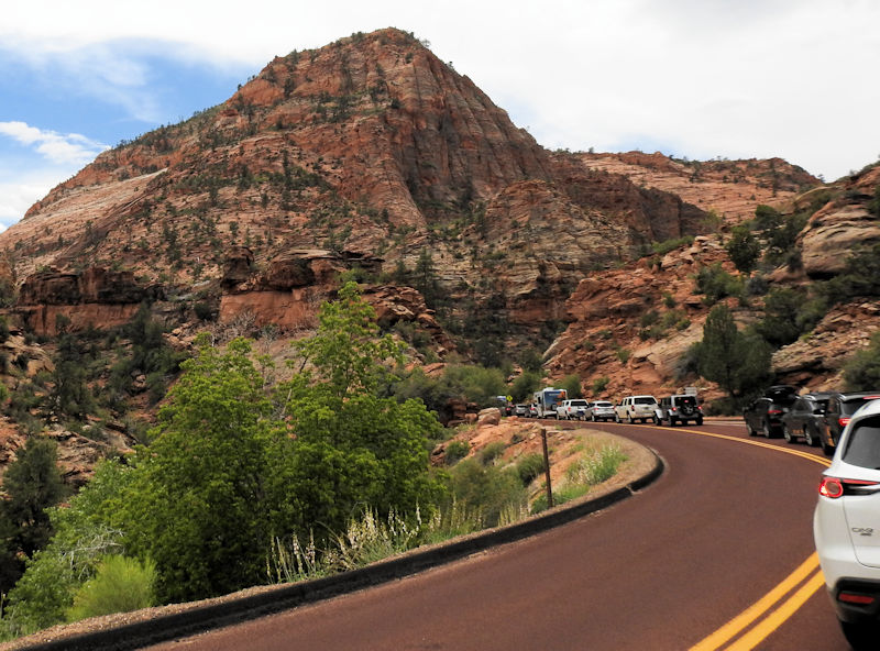
| Waiting to get into Zion |
It turns out it is only 30 miles from Kanab to the back door of Zion National Park, so we took a day and drove over. Zion has been our favorite national park for years, but unfortunately more and more people are agreeing with us until the park is now badly over-crowded. This trip when we went in there was a 25 minute line of cars backed up to get through the entry gate. It was particularly annoying since we have lifetime senior passes and don't have to pay any entry fee. I think they should have one gate set up to wave the pass people through. Of course, nobody asked me.
 |
| Zion Cnyon |
We drove through the east side of the park, stopping only at Checkerboard Rock, along with about 50 other people. We drove through the tunnel with only minimal delay. They stop traffic for RVs to go through the tunnel using both lanes but we were there in the early afternoon and no rigs were in site. I suppose they mostly leave earlier or arrive later. Then we wound down the serpentine Mt Carmel road to reach the floor of Zion Canyon. Down there, every parking spot had a vehicle in it. I suppose we could have driven around waiting
 |
| The Kolob Terrace Road |
for someone to leave but we weren't in the mood. Now that you can no longer drive through the canyon it would have only meant waiting for a seat on the shuttle bus. Instead, we drove out the west entrance and took the Kolob Terrace Road up to Kolob Reservoir. This is something we discovered a few years ago, a little 2 lane road that goes through the back side of Zion's western mountains up to a reservoir at about 8000 feet, The scenery is breath taking and the start of the road is outside the park in the town of Virgin so most tourists either don't know about it or don't bother with it. Anyway, the traffic was pretty light the day we were there and we really enjoyed it.
When we came back down to Virgin a couple of hours later we decided to return through Hurricane rather than retrace our steps though the distance is about a wash. You take Utah 59 to Arizona 389 then over to Fredonia, AZ which is just 8 miles south of Kanab. I only knew Fredonia as the country that went to war in Duck Soup, but it turns out that the term was used as a humorous reference to the United States ever since the American Revolution. There are 17 towns called Fredonia in the US and one in Columbia. If you are ever in Fredonia, AZ, there is an excellent restaurant there called The Juniper Ridge. What it is doing there I have no idea but it is definitely worth the drive if you are staying in Kanab.
 |
| Preparing to start the tour |
The only other thing Kanab is known for is the Best Friends no-kill animal shelter and rescue. This is a pet rescue organization with the motto "Save Them All" that occupies 3700 acres in a canyon about 5 miles north of Kanab as well as leasing another 17,000 acres from the Bureau of Land Management in Utah and Arizona. The organization houses about 1600 animals at their Kanab site including not only dogs and cats but horses, pigs, parrots, guinea pigs, sheep, goats, rabbits and a few wild animals. They now also have facilities in Los Angeles, New York, Salt Lake City and Atlanta. Although they do have some permanent animal guests, their goal is to find permanent homes for their charges and they generate about 1800 animal adoptions per year.
They also provide spaying and neutering services to try and decrease the number of unwanted animals out there. In fact, they have found that feral cats will not stay in an adoptive home, so they have a program where they just round them up in big bunches, neuter them and then release them back out into the wild.
We visited the shelter one afternoon while we were in
 |
| Puppy who just got fixed |
Kanab and listened to their pitch. They have reduced the killing of healthy but homeless pets by about 80% in this area which is amazing and commendable I suppose but there is a certain amount of sanctimony involved. We had a bad experience with an incorrigible rescue dog some years back and I personally will never go through that again. I prefer to raise my own incorrigible dogs, thank you very much. The tour of the facility was less than I expected. Having a bunch of strangers wandering through their animal care facilities is disruptive so what you mostly get to do is drive around the property and look at buildings. I really didn't need that and could have learned all I wanted to about Best Friends online. Still, I have to admit they are doing good work and am happy they are there.
 |
| Sun going down in Johnson Canyon |
 |
| The Kolob Reservoir |
 |
| Ducklings in the reservoir |
 |
| A mule deer crosses the Kolob Terrace Road |
 |
| Deer trio |
 |
| Along the Kolob Terrace Road |
 |
| In the Cat House |
 |
| Bird feeder at Best Friends Animal Sanctuary |