Saturday, September 26, 2015

Yellowstone, Because It's Not on Fire

Yellowstone, the alternate destination.
After we left West Glacier, the master plan called for driving around to East Glacier where we were supposed to meet up with Paul and Ruth again for a week.  A couple of things made this unwise.  First of all, Paul and Ruth were back in Washington after Paul developed some increase in his back problems.  They will hopefully get back on the road later this summer.  Second, you will recall that East Glacier is still actively burning, making it a less than desirable destination.  Our ultimate goal was to get to our rental house in the Black Hills about the time the last scheduled tenants for the summer left at the end of August.  We were perfectly happy to take a leisurely drive across Montana, but even we can't drive that slowly.  We had some time to kill.  So we called around and managed to get ourselves a week long camping spot in Gardiner, at the north entrance to Yellowstone.

Group of bison ogling a herd of tourists
We were last in Yellowstone in 2010 and spent a week (half in West Yellowstone and half in Gardiner)  and we went just about everyplace you could go on 4 wheels so we didn't feel we desperately had to see everything again this trip.  We mostly wanted to do some wildlife viewing and were not particularly interested in breathing the sulfur fumes down in the geyser basins.  The one place we did not go the last time was the Lamar Valley, in the far north east corner of the park, so on the first day that's where we headed.  It turned out this was bison country. 

Pairing off
Now normally bison wander in segregated herds, the females congregating in larger groups than the males.  But August is the mating month and they all come together in one big happy buffafamily.  Males and females do some dancing around each other and gradually pair off.  Here you can see a large male staying close to his chosen sweetheart.  Does he protect her?  Provide for her?  Bring home the buffabacon?  Well no, not really.  He is mainly there to drive away competitors while waiting for her to go fully into estrus.  Then he will do his best to get a new little buffalo started before he bolts back to join his brethren and tell bawdy stories about his male conquest for eleven months.  Raising the kids?  That's her problem.  Life is good for the male bison.
How romantic
A lone pronghorn comes to the party "stag".

The elk mate in September, so we were a little early for that show.  The males were all up in the mountains somewhere preparing  their head mounted weaponry for battle, but the females were hanging out around Mammoth Hot Springs and the Gardiner River posing for pictures.  You can see a few here.

Elk cows hanging around Mammoth Hot Springs
Lunch time


Calf crossing the Gardiner River


Out on the prowl
We did drive over to West Yellowstone and visited the Bear and Wolf Discovery Center.  In the old days, of course, you couldn't visit Yellowstone without seeing a dozen bears sitting on the edge of the road begging for tourist handouts.  But now that such interaction is strongly discouraged,  it is pretty uncommon to see bears out and about in the park.  The Discovery Center has about a dozen grizzly bears that, for one reason or another, can't live in the wild.  The most common reason is that they became accustomed to humans at some point and are now considered too dangerous to roam at will.  Rather than just shoot them, they are adopted by the center so we tourists still have a way to get our grizzly fix.  About once an hour the keepers hide food around the display enclosure, then let out a couple of the bears to "forage".  Of course, the bears have learned all the hiding places and they know that if there isn't anything in hiding place A this time around, there is sure to be something in hiding place B or C, so they just methodically make the rounds.  At least it brings them up close to the audience side of the enclosure for a good look, and they are impressive to look at.
Dozens of crows fly in to steal their share of bear food
Grey wolf
There is a similar routine with the grey wolves but there are fewer of them and they only eat a couple of times a day, so you need to be there at just the right time.  The center also has a few eagles and other raptors and, for god only knows what reason, an enclosure for ground squirrels.  These seemed a little out of place amongst all the top predators.  As one of the more interesting displays, they had a collection of maybe 2 dozen "bear proof" food and garbage containers that had been successfully ripped open by determined ursines.  Clearly, bear proof is a relative term.
Bald Eagles
"What the hell am I doing here?"
By our 5th day in Gardiner the smoke from the numerous fires to the west had really moved into the area and going out sight-seeing became more depressing than enjoyable, so we just hunkered down in our RV and read or did chores for the last 2 days.  Then we packed up and headed east again.

Wednesday, September 16, 2015

Glacier

Near the start of the Going to the Sun Road

In 1887, Theodore Roosevelt founded the Boone and Crockett Club.  He idolized Daniel Boone and Davy Crockett as pioneering men who hunted extensively while opening the frontier, but (at least in Teddy's imagination) realized  the consequences of over-harvesting game.  (Boone only began to realize these consequences late in life, after he had helped wipe out all the buffalo and much of the other large game in Kentucky and had to move to Missouri to find more.  Davy Crockett only gave up shooting wildlife to go shoot Mexicans instead.)  The club was (and probably still is) basically a group of wealthy men who wanted to preserve nature and wildlife primarily so they could go out and kill it.

Two members of the Boone and Crockett Club, George Grinell and Henry Stimson, became enamored with the area between the Flathead and Blackfeet Indian reservations in the late 1800s so they got the club to spearhead efforts to preserve the area.  They got help from the Great Northern Railway which had built a line through Marais Pass and wanted to promote tourism along the tracks.  They were opposed for awhile by mining interests, but when it finally turned out there was nothing there worth mining, they were finally able to lobby congress to designate the area as Glacier National Park in  1910.

For 20 years the main way to reach the park was by rail, so Great Northern's lobbying dollars paid off handsomely, but by the 1930s vacationing by car was becoming the norm and in 1932 the Going to the Sun Highway was completed.  We learned while we were still in Washington that the eastern half of the road was closed due to fires and the air was pretty smokey when we arrived at West Glacier, but when we drove into the park the next day we discovered that they had managed to open the Going to the Sun Road all the way through... sort of.  You could drive all the way from West Glacier to St Mary, but on the eastern half of the road you were not allowed to stop your car and you "might" still see areas of smouldering or burning trees.  Not knowing what to expect, we headed up the road.

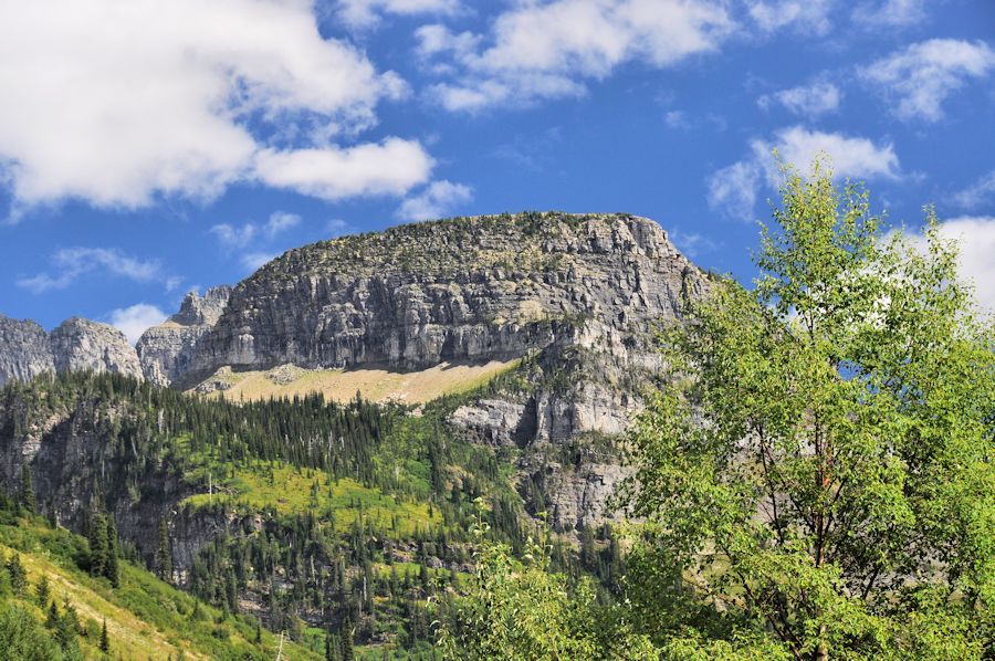
It turned out to still be pretty impressive.  The air was hazy but not as bad as Spokane or Missoula had been.  And when you got near the summit (which took us about three hours) the scenery was truly gorgeous.  We drove to the top and a few miles past, then decided we weren't really interested in seeing the burnt out eastern slope, turned back around and  went back to West Glacier.  The pictures can tell the rest of the story.  Enjoy.


Two Medicine Lodge
The next day we drove over the previously mentioned Marais Pass along the park's southern border and into the east side of Glacier to Two Medicine Lake.  Before the Going to the Sun Road was completed and most visitors arrived by train, this is where you went if you visited Glacier Park.   Now it's a lesser known secondary destination.  No one told us what the two medicines were.  I'm guessing they were just aspirin and Tylenol but I hear bear bile was popular among the natives for much the same reason that Viagra sells so well today.  It was a nice day trip that resulted in a few more pictures to share.  We considered driving up to look at some of the devastation further north but decided there was no point in getting all depressed so instead we drove out Hwy 89 a ways into the Backfeet Indian Reservation.  Although it is a major US highway, this is Indian land, so after a few miles the pavement disappeared and we drove on gravel as far as Browning, then got back on US 2 and returned to West Glacier.
Rising Wolf Mountain at Two Medicine Lake
One odd thing  about the RV lifestyle is that you do keep running into folks. We met a couple at our campground in Oregon named Geoff and Mary Jan parked a couple of slots over from us.  They seemed really nice and had recently moved into a smallish RV and come out west from North Carolina.  Fair enough.  Then after we had been at Chimicum a couple of weeks we were walking the dogs one evening and who should we run into but Geoff and Mary Jan.  Now that seems like a bit of an odd coincidence but life is sometimes that way.  So we left them in the Olympic Peninsula and headed off to Spokane and Missoula and then on up to Glacier.  When we pulled into our campground in West Glacier, guess who pulls into the driveway right behind us?  Yep, Mary Jan and Geoff.  Now this is starting to get creepy.  I'm pretty sure at this point that we are being stalked.  Anyway, we went out to dinner with them a couple of times and discovered that, strictly by chance, we will also be at Yellowstone together.  Then they are supposedly heading back to Durham, NC for some family get together.  If they show up at our house in the Black Hills, I'm calling the FBI.

Tuesday, August 18, 2015

Where Montana Began

We finally left the Evergreen-Coho campground and headed east, down the hood canal and across the Tacoma Narrows Bridge.  We had been warned that the traffic through Tacoma would be horrible, but it turned out not to be all that bad.  When you come from Southern California, it takes a LOT of cars to get on your nerves.  We spent a night in Ellensburg right on the Yakima River, which should have been nice, but it was 102 degrees in Ellensburg so as near as I can remember we just cranked up the AC units and hunkered down in the motor home, then hit the road again the next morning before the heat started building back up.

Riverside Park in Spokane through the smoke
Our next stop was Spokane.  We had intended it to be Couer d'Alene but the only campground there that could reasonably accommodate our rig was full, so we stopped a little short and spent 2 days in Spokane.  It's a frustrating town to drive through.  The main drag is about 8 miles long and has stop lights every 100 yards specially timed so that you are guaranteed to have to stop at about 3/4 of them.  In our bus-sized vehicle that is not a pleasant experience (though I suppose the buses do it everyday).  We finally got to our campground at the north end of town and got it set up, then turned around and drove right back down town in the car where we ate at a Korean restaurant that turned out to be pretty good.   We kind of got hooked on Korean food when we lived in Hawaii back in the eighties.  When we first came back to the mainland you couldn't find a Korean restaurant here but they are becoming more and more common and in unexpected places.  There are at least three of them in Temecula.  On the way back through the signal gauntlet to get home we were overshadowed by a plume of smoke rising from the west of town.  We never did hear what that was all about, but the next day all of Spokane was smokey and our car was covered with a thin layer of ash.

Programmed water fountain
There is not a whole lot to see in Spokane.  They do have a nice riverside park downtown that we went and wandered around in for an hour or so.  There is a pretty cool water fountain there that puts on a varying show, changing patterns every few minutes.  There is also an old carousel that was fun to look at through the windows of its enclosure.  It wasn't scheduled to open up for a couple of hours yet when we arrived and seeing it in action wasn't worth the wait.  The Spokane River goes over a falls just west of the park and was used to run an early hydroelectric generator which is still in use but they didn't tell us what percentage of the city's electricity it produces.  We had planned to take a scenic drive up to the top of Spokane Mountain but with the visibility at only 4 or 5 miles tops, we decided to skip it.
Antique Carousel
Frank's Diner
That was about it.  The next morning we got up and went to Frank's Diner, an eatery in an old railroad car that was parked right across the street from our campground.  In the early part of the 20th century it was the posh, private rail car of the president of the Northern Pacific Railroad.  It was retired by the railroad during the Great Depression and converted to a diner in Seattle in 1931.  It was moved to Spokane shortly thereafter and is something of a local legend.  After waiting in the smoke and 85 degree heat for about a half hour we finally got to go in.  The seating was pretty tight for someone my size but the breakfast was excellent.  If you are in the area give Frank's Diner a try.  Then hit the road for someplace else like we did.

Someplace else was Missoula.  This is where we got our flat tire fixed 2 years ago which you can read about here.  We stayed in a really nice campground on the west end of town about 1/4 mile from the truck stop that  replaced our flat.  There were no fires nearby, but the prevailing winds were apparently funneling smoke from distant fires both west of us in Washington and north around Glacier Nat. Park right down the I-90 corridor so while it wasn't quite as smokey as Spokane, it was far from clear the 3 days we were there.

Oldest Pharmacy.  Hills barely visible in background are only a mile away.
We did explore the area somewhat.  We took a scenic drive down the Bitterroot Valley from Missoula.  In the town of Stevensville we found the St. Mary's Mission complex "Where Montana Began".  When we visited Coeur d'Alene 2 years ago we visited the Cataldo Mission about 8 miles east of town.  You can read about that here.  That mission is the oldest still extant building in Idaho and was founded by Father Pierre Jean De Smet in 1842.  Well, it turns out that a year earlier this self-same Fr. De Smet had founded the St. Mary's mission in  present day Stevensville, although at the time it wasn't known as Stevensville. It was just known as some God forsaken place out in the middle of the prairie.  The buildings there are the oldest in Montana.  Before that, Fr. De Smet had founded missions in Iowa and after Cataldo he wandered around the west doing missionary work until 1846, leaving other Jesuits behind at various places to do the actual work of getting buildings up and whatnot.  Then he went back to St. Louis and spent the next 20 years fund raising among the faithful in the East to keep all these missions going.  Much like today if you're a Baptist.
St. Mary's Mission
Very old bottles
The mission building has a kind of telescoping design.  We didn't go in because you had to arrange a tour in advance.  A small cabin on the site is the oldest pharmacy in the west as indicated by the display of very old bottles in one of the windows.  There are a couple of other buildings and displays and the old church graveyard.  While Stevensville is obviously proud of its historic past, little else seems to have happened there and it remains a tiny 3 street town out in the middle of the prairie, but maybe just a wee bit less God forsaken.

On the way back to Missoula we stopped at the Traveler's Rest State Park.  The name comes from Lewis and Clark who camped here on their way west in Sept 1805 and again on their return trip in July, 1806.  This area has changed little in the 200 years since their Journey of Discovery.  Interestingly, while you can follow what we think is the "Lewis and Clark Trail" from St. Louis to Astoria, this is the only place where we have any archaeologic evidence that Lewis and Clark were actually here.  The story is interesting (and a little disgusting).
Lewis and Clark trading with the natives
Lolo Creek
Traveler's Rest was designated as a National Historic Landmark in 1960 but they had it in the wrong place.  Historian's thought the camp was at the confluence of the Bitterroot River and Lolo Creek, but careful reading of the explorers' journals lead some to believe the campsite was actually a few miles up Lolo Creek and they went looking for it.  In 2002 they found the evidence they were after in the form of one military coat button and a lump of melted lead in a fire pit left from making musket balls.  These seemed like pretty thin gruel to me, but here is the clincher.  The campsite appeared to have been laid out according to American military specifications of the time.  From this they knew exactly where to look 75 yards away for the camp latrine.  From the journals they knew the expedition medic had been
Site of the tell tale latrine
handing out powerful laxatives to some bound up members of the party which contained mercury
(not recommended these days).  So they went and dug up the latrine area and, sure enough, found traces of mercury in the latrine pit from somebody's 200 year old pee.  Ain't archaeology grand?

We walked the 3/4 mile trail around the camp area and learned that, other than a few rocks that were supposedly parts of fire pits, there is absolutely nothing left there to see.  Just dirt and grass.  But we did stand on a spot where Lewis and Clark likely stood.  And at least the trail was flat.

The whole area around Missoula looked like it would have been beautiful if there were less smoke in the air and there were points of interest we didn't have time for, so we are already talking about coming back and spending a little more time here some year when the west isn't on fire.  In the meantime, we will be hitting the road for Glacier.  What's at Glacier?  Well, at the moment there is fire.